


clécy 15km

rollondesbois
User
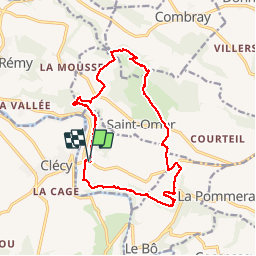

Length
14.8 km

Max alt
262 m

Uphill gradient
445 m
Km-Effort
21 km

Min alt
44 m

Downhill gradient
446 m
Boucle
Yes
Creation date :
2018-04-16 23:25:44.721
Updated on :
2018-04-16 23:25:44.721
4h17
Difficulty : Medium

FREE GPS app for hiking
 SityTrail
IGN / Geographical institutes
SityTrail Plus
The world is yours!
About
Trail Walking of 14.8 km to be discovered at Normandy, Calvados, Le Vey. This trail is proposed by rollondesbois.
Description
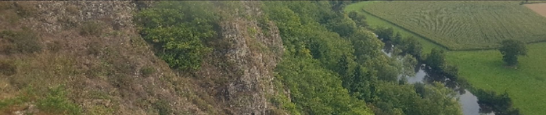
Superbe
Photos


Positioning
Country:
France
Region :
Normandy
Department/Province :
Calvados
Municipality :
Le Vey
Location:
Unknown
Start:(Dec)
Start:(UTM)
685301 ; 5421310 (30U) N.
Comments